Using the Map View

Using the map view is an ideal way to display addresses and geographical coordinates on a map. Worldwide address systems are supported.
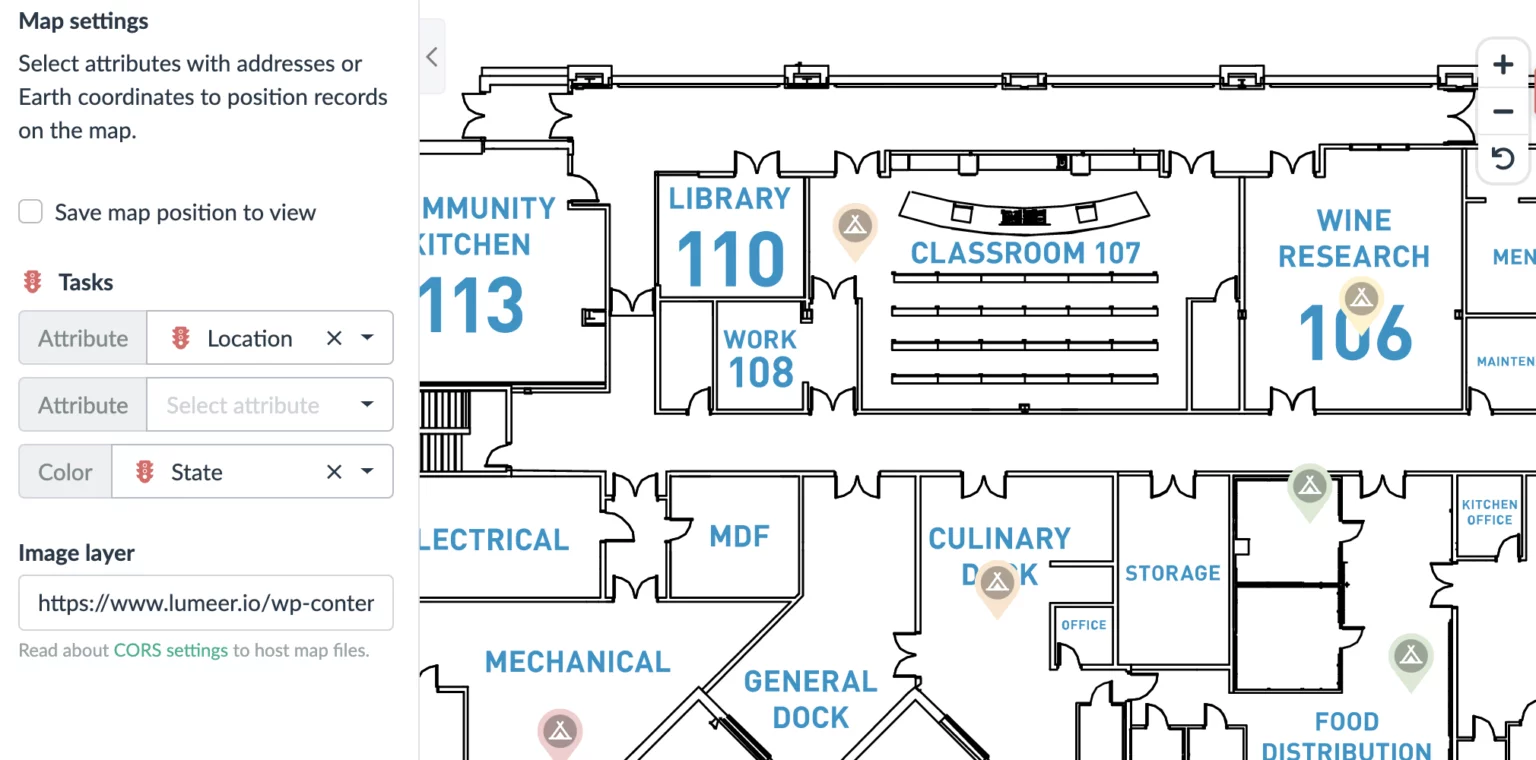
Moreover, there is the possibility to add a custom map layer (like a blue print). This can be useful to position tasks related to a building maintenance for example.
Configuring the View
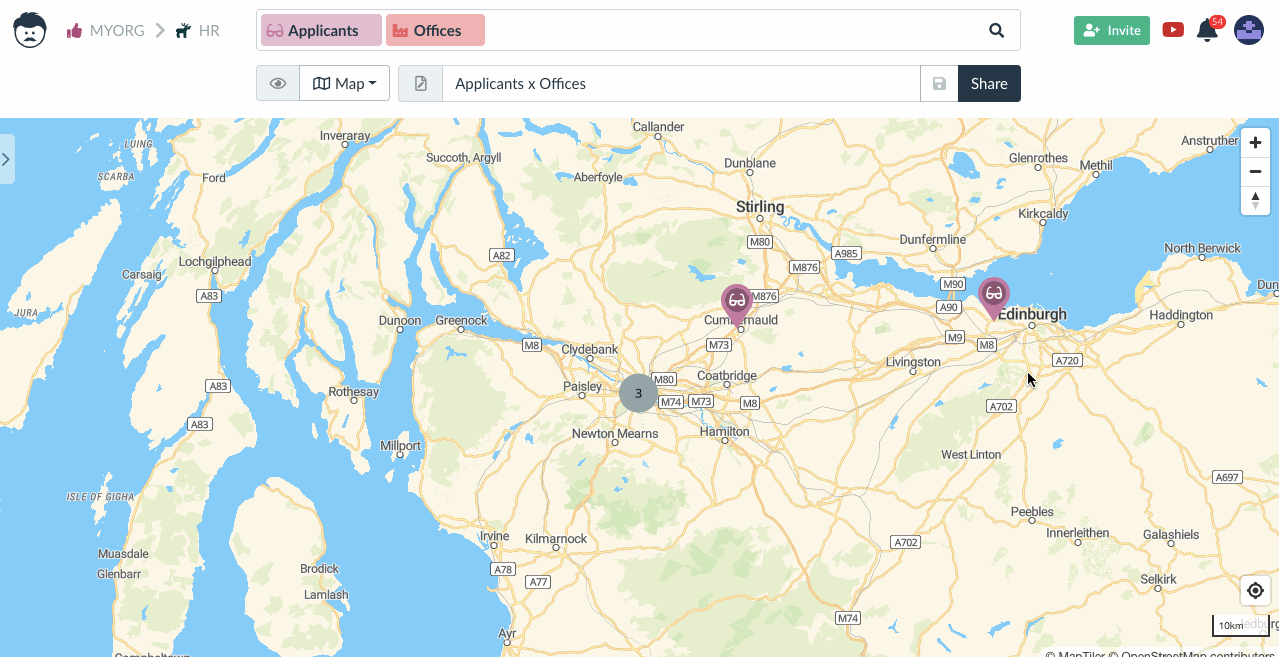
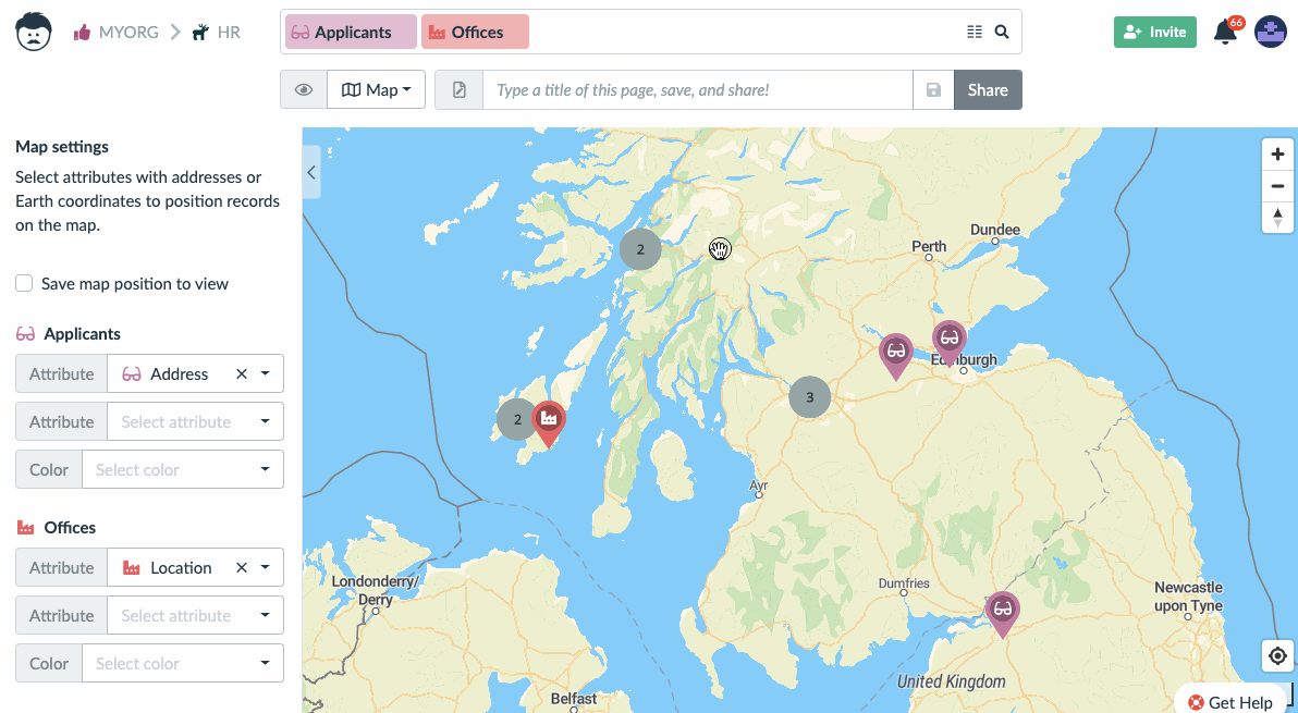
Multiple tables or sources of location can be used at the same time and mixed on a single map. For example offices and candidates, or delivery addresses and stores, etc.
Just add all the desired tables to the search bar.
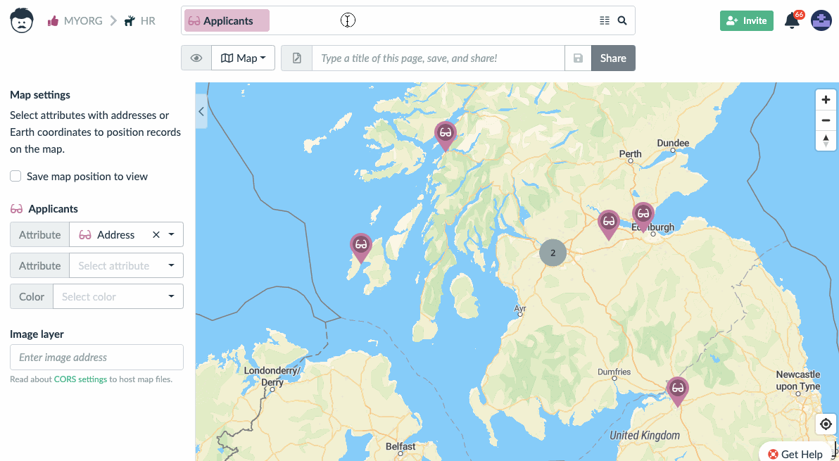
Lumeer will automatically detect attributes with addresses or coordinates. If you wish to use different attributes, you can change the setting in the sidebar.
You can also pick a color of the pins – by default, Lumeer will use table color. Also the table icon is used to differentiate pins from multiple sources.
Moving Around the Map
Drag and drop the cursor to move around the map. As you zoom in, pins that are near each other become visible.
Custom Map Layer
For specific cases, like very detailed maps of specific locations or buildings, it is possible to use your own map layer. The layer is specified in the form of an address (URL) to the file.
We also recommend checking the configuration of the CORS headers of the server hosting your map files.
We recommend using vector graphics (SVG) for the best performance. However, JPG and PNG are also supported. The layer size limit is 20MB.
You can easily host your images on Google Drive. Just follow this simple how-to.
Using the Map View to Work With Your Data
The items on a map can be moved by a drag of a mouse. In the case of address fields, a new nearest address is assigned automatically.

The detail of each item can be directly edited by a double click on the pin.